|
San Juan Mountains, Wolf Creek Pass Highway
Driving:
From Pagosa Springs, Colorado, I leave out on US 160, starting at the first crossing of the San Juan river putting the river on the north side of the highway. Then, I continue to drive northeast on US 160 which very quickly begins to rise in elevation while following the San Juan River, now to my west. At five miles from the previous river crossing, the San Juan crosses back under the highway. Soon after, at nine miles from the starting point, the East Fork San Juan River departs from the highway to the east (right) while US 160 continues a northerly heading.
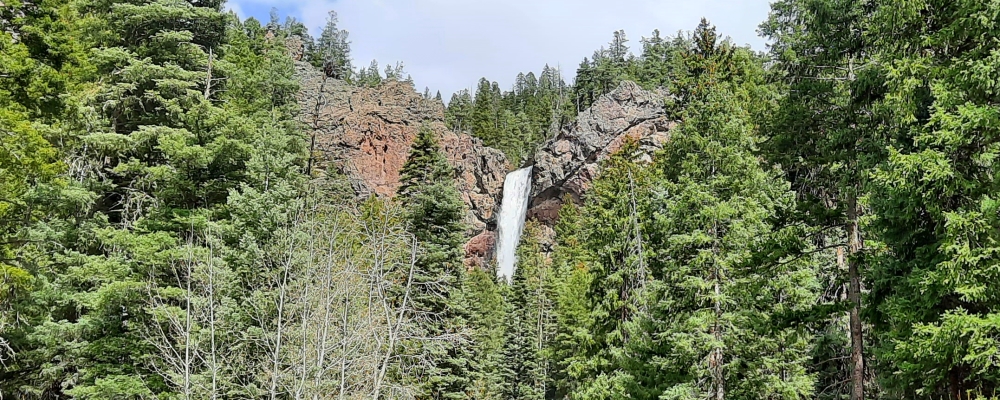
I continue north on US 160 and soon after come upon the West Fork of the San Juan River but it too departs to the west. Next, (now at nearly fifteen miles from the starting point), I arrive at Treasure Falls and pull right into the parking lot.
After take a few photos, I then continue upwards on US 160, cross Wolf Creek, and in less than two miles soon arrive at Wolf Creek Valley Overlook where I again stop (at about seventeen miles) and take photos looking down into the valley were I have just come from.
Continuing upwards on US 160 from the overlook, I pass another waterfall on the left (at eighteen miles), and continue up towards the pass now following Wolf Creek on the right of the highway. Upon arriving at the summit of Wolf Creek Pass, (at twenty-thee miles from the starting point), I turn into the large parking area and take photos of the sign and the snow covered landscape.
Location:
US Highway 160 east from Pagosa Springs, Colorado
Treasure Falls
Coordinates:
37.442181, -106.877318
Elevation:
8118 feet
Wolf Creek Valley Overlook
Coordinates:
37.450276, -106.888961
Elevation:
8650 feet
Wolf Creek Pass
Coordinates:
37.482959, -106.802246
Elevation:
10,856 feet
Geographical Region
Wolf Creek Summit (April to October)
San Juan Moutains
Wolf Creek Summit
Pagosa Springs Hot Springs Resort
Treasure Falls
Wolf Creek Valley Overlook
Wolf Creek Pass
|