The Wayƒarers Journal ©

The Journal

The Wayƒarers

The Selƒ

The Journey

The Burden

The Mountain

   The Ancients
   The Earth
   The Life
   The Modern Man

     Architecture
     Boats
     Bridges
     Forts
     Grand Lodges
     Lighthouses
     Piers

   The Nonpareils
   The Steps
   The Way

The Appendix

The Wayƒarer
The Mountain
Go to bottom of this page
THE BRIDGES
The Covered Bridges

The Taftsville Bridge, Conneticut River, VT-NH Go Down Go Up
Coordinates: Taftsville, Vermont
Bridge Type: Covered Wood Truss

The 2015 Journey Taftsville Bridge Go Down Go Up
(Day 812 JO) 35°F. 5:01 am
I am awaken by the near freezing temperature and start the jammer′s engine for some warmth. As it begins to warm up inside, I slowly remove the sleeping bag and get dressed with my winter blues. Then, I drive to the f-mart for coffee, WiFi and to work on my journal while drinking the cup of hot. Soon, I continue eastward on US highway 4 to find a congregation with a Thursday meeting but I fully intend to return here and visit my friends another time; the highway takes me up on the mountain and over the pass near Killington Peak.
The Covered Bridges
The Taftsville Bridge
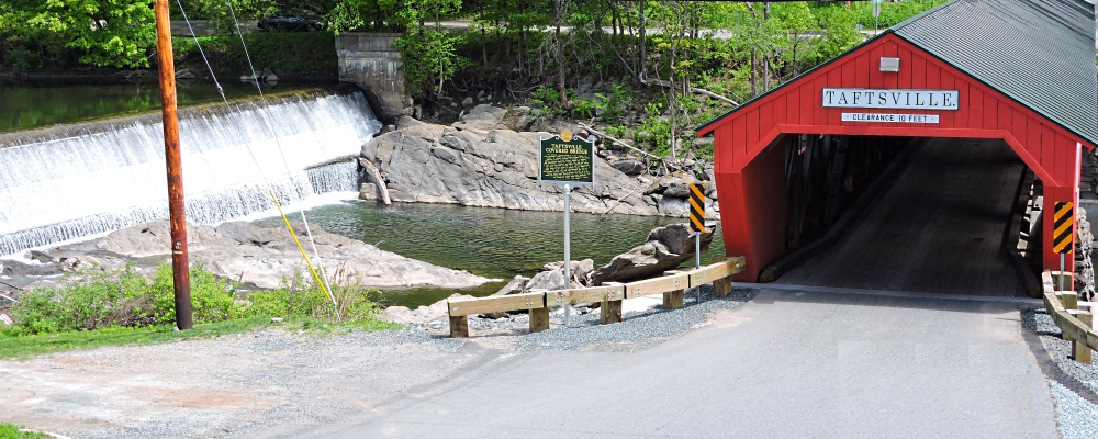
(m4bridge-covered-vt-taftsville-2015-0521.0941) The Taftsville Bridge from Above Dam
The Covered Bridges
The Taftsville Bridge
(m4bridge-covered-vt-taftsville-2015-0521.0946) Taftsville Bridge, Vermont

To go back to Covered Bridge Index, click down arrow. Go Back Go to previous section
on this page

Thank you for visiting The Wayƒarers Journal.

See Ya above the Treeline!

This Page Last Updated: 30 April 2026


To continue to the next Episode Level page, Click here go to top
 
The Wayƒarers Journal © ::: Come Join the Journey ™
by Thom Buras
Come Join the Journey ™