|

|
|
|

|

|
|
Lower Libby Dam Campground Park, Montana,
|
|
| |
|
|
Lower Libby Dam Campground Park Campground
The Lower Libby Dam Campground Park is located along the Kootenai River below the Libby Dam. There are several designated campground called Recreation Areas (RA) along both sides of the Kootenai River below the dam. The RAs can be reach from SH 37 after turning off onto National Forest Road 288 (FR 288). A short distance further north on FR 288, which immediately provided an access to Blackwell Flats Recreation Area. Then after another short drive, there is a sign with the words Libby Dam on the right at a side road called Warland Road. Turning on Warland Road will provide immediately provide access for the Alexader Creek Recreation Area, also on the right. Then, if you continue north on Warland Road for another mile, it will turn eastward just below Libby Day and cross over the David Thompson Bridge.
On the east side of the Kootenai River, further south and accessed only from SH 37 on the east side of the Kootenai River, there is the Dunn Creek Flats Campground and Boat Ramp. In previously years, all of the above campsites were free of charge, however, now they all require registering online and paying a camping fee per night for camping.
Just below the David Thompson Bridge there are three campsites know only as the Downstream Campsites, one on the west side, number 3, and two on the east side, number 1 and number 2. These three campsites are the only three campsites in the entire Lower Libby Dam Campground Park that are free campsites.
Coordinates:
48.3696400, -115.3208400
Elevation:
2105 feet
Geographical Region
Rocky Mountain Region of Montana
Ancient Steps:
|
| |
| |
|
|
Onsite:
Nearby:
Libby Dam with visitor center, and a overlook on both sides.
The area below Libby Dam before the Big Bend has three campgrounds situated alongside the river, one on the east side, called Dunn Creek Flats Recreation Area and two on the west side called Alexander Creek Recreation Area and Blackwell Flats Recreation Area. All are a part of the US Army Corps of Engineers Recreation Area facilities.
|
| |
| |
|
|
General Information:
The Army Corp of Engineers built Libby Dam on the Kootenai river about two miles north of this campground. During the construction the Corp also built a visitors center on the west side of the river Thompson bridge just below the dam as well as roads, campsites and viewpoints.
All of these roads, bridges and campgrounds were put in place and became operational while the dam was being built. Now, there serve as access to several boat ramp, campgrounds and viewpoints that line both sides of the lake and river.
Camping Reservations:
Recreation.gov
Camping Seasons
Peak Season:
22 May 2026 to 06 September 2026
Camping by Reservations only
Fees, Camping:
$10.00 per site, per night
First-come, First Serve Season:
07 September 2026 to 30 November 2026
Camping by Registration form
Fees, Camping:
$0.00 per site, per night
Free Camping:
Location:
Downstream Camping Area
Three Sites, See Map
Recreation Areas (campgrounds) Includes:
Each Recreation Area have a hard surface loop road, vault toilet,
dumpster and/or trash receptacle, picnic area and boat ramp.
Campsites:
Each campsite has gravel pull through campsite parking, picnic table, fire pit-grill
and some have lantern hangers.
There are no hookups, no water, and no RV dump.
Some campsites have a hard surface parking area.

|
| |
|
The 2026 Journey,
Libby Dam CG Park, Montana


|
|
|
(Day 881 TS) 58°F. 7:30 am, sunny
Journey On™, Day 147
After awaking in Kalispell, Montana, and purchasing a cup of hot coffee and a cup of hot water, I leave the city of Kalisspell, Montana, first driving south on US 93 about three or four miles to reconnect with US 2, turn right and travel westbound for ninety miles on US 2 to Libby, Montana, and then east on Montana State Highway 37 (SH 37) for another fourteen miles to the
Blackwell Flats Recreation Area Campground (BFRAC), which travel takes less than two hours, pull into the same space that I have used several times before and then set up my solar panels outside along the side of the jammer.
A short time later, two volunteers stop, ask if I have a reservation, to which I say no. The tell me that the space is ten dollars and I will have to go online to register for the campground space. I then ask to speak with a ranger, to which the two volunteers say ok and leave. About ten minutes later, a ranger, whose name is Susan stops and tells me the same thing: Go online, register and pay ten dollars. I then show her my Federal Veterans Pass and ask, will this change anything? She looks at the pass and says, Yes, that pass will drop the cost to five dollars, but you will still need to go online for the reservation. I then tell her, I do not have any phone signal here, are there any other options? Susan says, "Yes, we have three campsites which are free", hands me a map with the two campsites still available circled and say, "You can camp at either of these campsites."
I take the map, pack up my solar panels, start the jammer engine and drive upriver to just below the dam, cross the David Thompson Bridge over the Kootenai River, turn right immediately after crossing the river, and just downstream of the bridge, I see the two campsites, the second one being the only one available. I stop at the information kiosk to pick up a registration form, as the ranger had told me to do but the kiosk was completely out of the forms. So, I drive to the campsite, set up my solar panels so that I can begin charging my lithium iron phosphate battery (LiFePO4). I look around at my location and see that the Libey Dam looms large just a few hundred yards to the north of where I am set up. Just below the dam is the David Thompson Bridge and coming out from the powerhouse at the bottom of the dam is the Kootenai River, which flows southward past where I am parked on the east shore of the river.

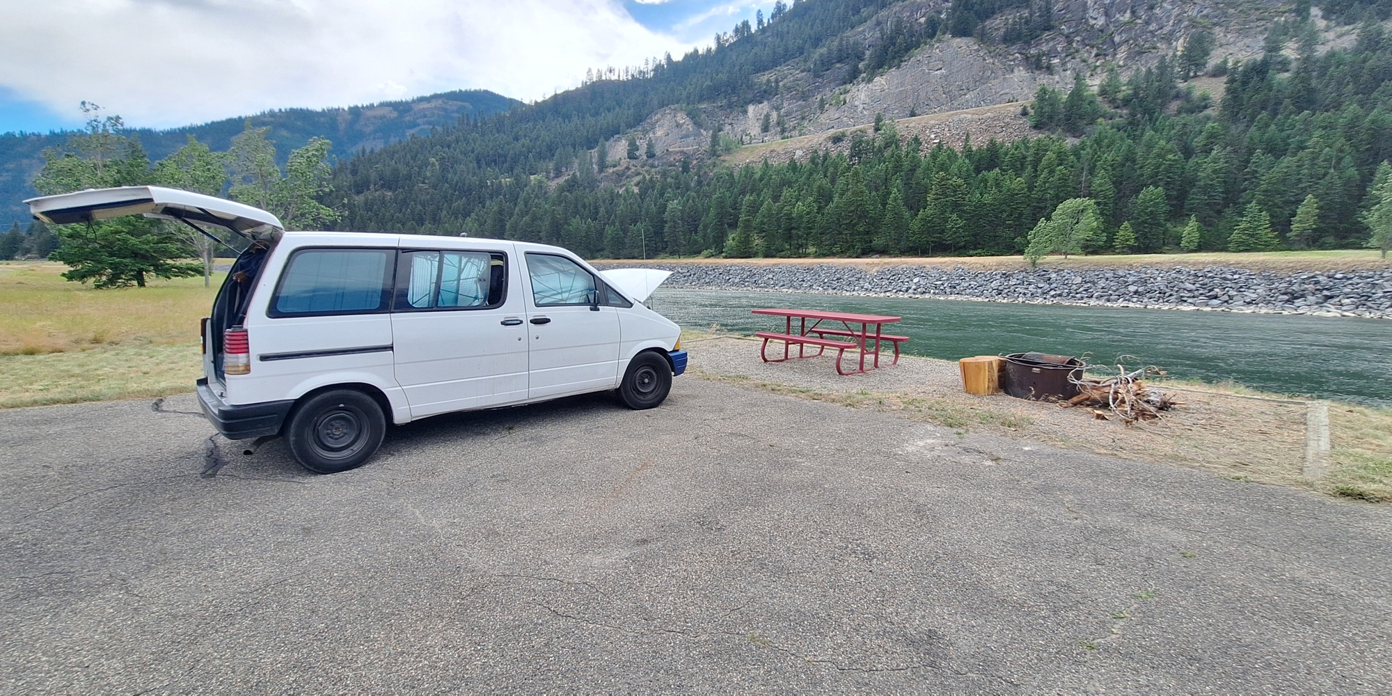
Downstream Campsite number 2 has a picnic table, fire pit, a lantern hanging pole, trash receptacle and an asphalt parking area.
From the parking lot where I am camping, there is no access to the river because the river here has a steep rocky embankment down some 50 or more feet to the water below and I do not see myself attempting to climb down through those large boulders. However, about five miles downstream, at the Blackwell Flats campground, the embankment is not any where near as high nor steep, and during previous camping visits, I had easily accessed the river to fill my bucket in order to wash both myself and the jammer.
Furthermore, the BFRAC has a vault toilet at a walking distance from that campsite, however, at this free campground, which I will hence call the Downstream Free Campground (DFC), does not have a nearby toilet facility. Needless to say, in the morning, I will have to leave this campsite, drive to the BFRAC or any of the other vault toilets here in the Kootenai River/Libby Dam Park to use the facility there before I make my departure from this park.

After setting up, I walk the perimeter of the campsite to photograph both the campsite as well as Kootenai River valley, the Libby dam and the surrounding mountains.


With still a lot of daylight remaining in this day, I get out my floor jack, lift the drivers side, crawl under and do a fuel filter replacement. Next, I get out my scrub brush and some water and I scrub the entire front end of the jammer to remove over a mouth of bugs and the bug juice that they all so happily volunteers to share with me. Finally, I take a photo showing how clean the jammer is supposed to look like.

|
| |
|
The 2025 Journey,
Blackwell Flats RA Campground, MT
|
|
|
(Day 596 TS) 56°F. 7:25 am, cloudy
Journey On, Day 60
Sleeping in the Jammer
Blacekwell Flats USACE Camp, Campsite: 3
Day Eight
Yesterday, I had gone into town primarily to find a w-mart to have internet in order to connect to the weekend meeting. I ended up spending the morning at the arches where a seventy-five cent cup of coffee provided me with all the refills I could swallow. When, upon my return to Blackwell Flats campground, I notice that campsite number three is open, which is the only one with a large hard surface pad, so this is where I set up for my stay during the upcoming week. Also, the vault toilet is a few yards closer.


(Day
589 TS) 45°F. 6:30 am, sunny
Journey On, Day 53
Autumnal Equinox
Sleeping in the Jammer
Blackwell Flats USACE Camp, Campsite: 6
Day One
Last evening, as I drove into the campsite, I see that number 6 is available, drive into the campsite, park and begin setting up my gear by repositioning the table and then backing the jammer up to the table. Next, I open the rear lift door, get out my solar panels and then set the up in full sun.


|
| |
|
The 2022 Journey,
Blackwell Flats RA Campground, MT.
|
|
(Day
419 TN) 59°F. 6:30 am, rain
Summer Sojourn, Day 19
At eleven this morning, I pack out of the cafe, drive north through town to US 2, turn left and drive west towards Libby, Montana where I stop to add fifty dollars of gasoline to the tank. Next, I stop at a g-mart to purchase some organic vegetables, sprouted bread, chips and guacamole.
Then, I cross to the north side of the Kootenai river and drive upriver on SH 37 to near Fisher River where SH 37 crosses the Kootenai river to the southeast side and from there follows along the Kootenai on the east side of the river. However, just before SH37 crosses the Kootenai, I turn north onto FR 228, which follows the Kootenai on the west side of the river. I then continue north for a short distance and come to an Army Corp of Engineer Campground, pull in and find that camping here is free.

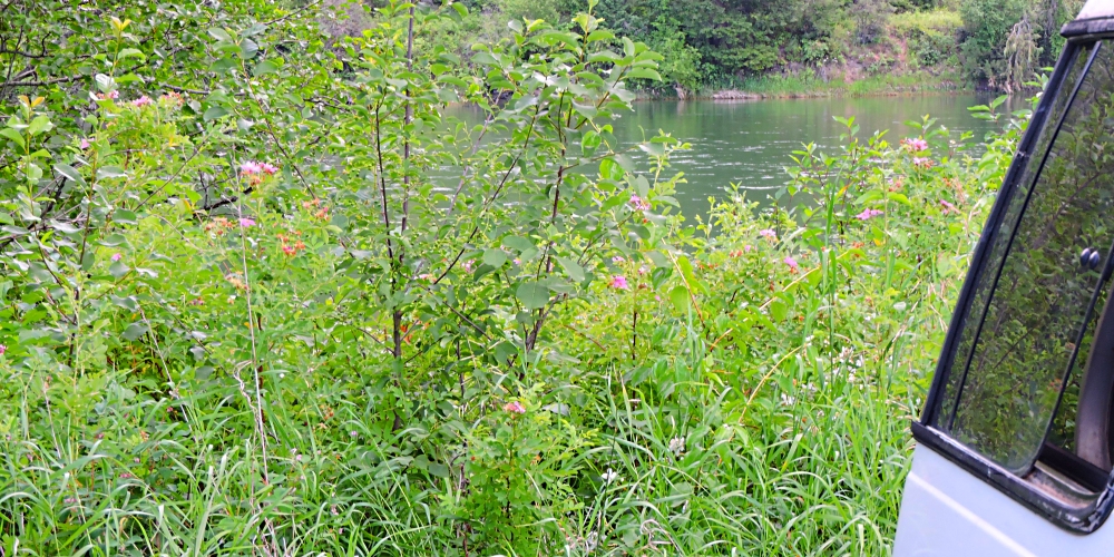
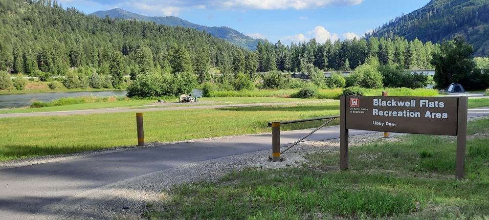
(m4camp-05-mt-blackwellflats-2022-0710.1433) The Blackwell Flats RA Campground, Kootenai River

(m4camp-05-mt-blackwellflats-2022-0710.1441) The Blackwell Flats RA Campground, Kootenai River
|
| |
| |
|
To go back to the Campsite Index, click on the down arrow.
|
|
|
Thank you for visiting
The Wayƒarers Journal.
| |
See Ya above the Treeline!
| |
This Page Last Updated: 31 October 2026
|
|
|
|
To continue to the next Episode Level page,
Click here

|
|
| |