|
Information:
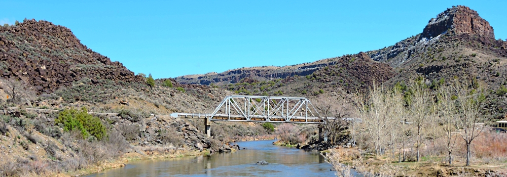
The Taos Junction bridge, also known as the Rio Grande Bridge
This bridge has day use parking at the site and is a drop site, with fairly heavy commercial raft use in the spring. The site is a very isolated gorge location with little access after put-in. Two hot springs along the river are popular depending on water level and at higher water level, the pools are flooded.
Rio Grande Del Norte National Monument
The monument includes approximately 242,555 acres of public land managed by the Bureau of Land Management. The landscape is comprised of rugged, wide open plains at an average elevation of 7,000 feet, dotted by volcanic cones, and cut by steep canyons with rivers tucked away in their depths.
The Río Grande carves an 800 foot deep gorge through layers of volcanic basalt flows and ash. Among the volcanic cones in the Monument, Ute Mountain is the highest, reaching to 10,093 feet.
The unique setting of the Monument has a wealth of recreational opportunities including: whitewater rafting, camping, hunting, fishing, hiking, mountain biking, and wildlife viewing. The Wild Rivers Recreation Area at the confluence of the Río Grande and Red River includes campgrounds, scenic viewpoints, and hiking trails.
La Junta Point, at Wild Rivers, provides a wheelchair accessible dramatic vista of the confluence of the two rivers. The Orilla Verde Recreation Area includes campgrounds near the river′s edge, as well as boat launches. The Taos Valley overlook provides stunning views and trails for hiking and mountain biking.
Driving Directions:
The bridge is located on State Highway 567 in Taos County where it crosses the Rio Grande River.
Location:
Coordinates:
36.33598, -105.73360
Elevation:
feet
Bridge Specification
Bridge Type:
Steel riveted Pratt Through Truss Deck Bridge
Date Open:
1930
Replaced:
An uncovered eight panel Howe Truss Bridge
Total Length:
152.9 feet
Deck Width:
18.7 feet
Main Span Length:
100.1 feet
Crosses:
Rio Grande River
Clearance Above:
(Vehicle Clearance) 13 feet.
Clearance Below:
(Vessel Clearance) about 20 feet.
|