The Potomac Heritage NS Trail Information
The Potomac Heritage Trail, also known as the PHT, is a designated National Scenic Trail corridor spanning parts of the mid-Atlantic region of the United States that will connect various trails and historic sites in Virginia, Maryland, Pennsylvania, and the District of Columbia.
The trail network includes 710 miles (1,140 km) of existing and planned sections, tracing the natural, historical, and cultural features of the Potomac River corridor, the upper Ohio River watershed in Pennsylvania and western Maryland, and a portion of the Rappahannock River watershed in Virginia. The trail is managed by the National Park Service and is one of three National Trails that are official NPS units.
Description:
Unlike most of the long distance hiking trails such as the Appalachian Trail, Pacific Crest, Continental Divide and others, the Potomac Heritage Trail is not a single path from one terminus to the other, but an informal route with numerous side trails and alternatives, some in parallel on each side of the Potomac river. Currently, many of these are separate, connected to the others only by roads.
The PHT crosses the Appalachian Trail near Harpers Ferry, West Virginia, and is concurrent with the American Discovery Trail along the portion of the C&O Canal Towpath between Oldtown, Maryland, and Washington, D.C.
Footpath Administrator:
National Parks Service
Footpath Year Established:
1983
Footpath Type:
National Scenic Trail
No permits required
Footpath Total Length:
1,100 miles
About 710 miles complete.
Footpath Use:
hiking and boating along the entire trail
limited bicycling and equestrian use
Highest Elevation on Trail:
3924 feet
Big Savage Tunnel, Maryland,
Lowest Elevation on Trail:
sea level
Geographical Region:
Appalachian Mountains
Geographical Region:
Coastal Plains
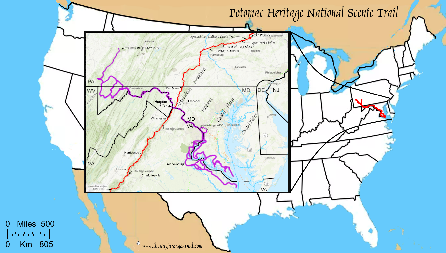
(m0-maps-pht-map) Potomac Heritage Trail Map